HuainanCoalfield: The coal basin of Permo-carboniferous period, lies in the south of coal gathered region of North China. It is located in the middle-north part of Anhui Province, whose main part is Huainan City, east extends to Chu County, west stretches near Fuyang, plane is like a long ellipse towards the direction of north-west-west, length is 100 km, width is 20-30 km and area is 2500 km².The Coalfield stretch across either side of Huai River .Because the discovery and development starting from the southern bank, it was named Huainan Coalfield. After that, though the coals were discovered in larger scale of the northern bank of HuaiRiver, the original name was reserved.
1. Geological structure:
Huainancoalfield is a synclinorium whose axis is towards north-west-west. It mainly constitutes by Upper Paleozoic Erathem,and the Lower Paleozoic Erathem lies in the south and north of the coalfield.And it is covered by Quaternary System .The southern and northern edges of the coalfield develop the reversed fault of low angle run, and that causes the Lower Paleozoic Erathem covering the Upper Paleozoic Erathem several times. In the synclinorium , a set of north-east fault developed, cutting the Upper Paleozoic Erathem into pieces like ladder. The coal system of Permo-carboniferous Period generally exists in the synclinorium ,and always forms sub-grade fold .The movement of the magma in the Yanshan Period are mainly constituted by small fine crystal stone, lamprophyre stone vein and stone bed intrusive coal system ,which influence part of the coal seam .
Coal System The coal bearing strata of Huainan Coalfield belong to the coal system of Permo-carboniferous Period of the North China Type, which contain Later Coal Epoch Formation ,Taiyuan Formation ,Shanxi Formation and Lower Shihezi Formation of Early Permian Epoch and Upper Shihezi Formation .The main coal bearing strata are Upper Shihezi Formation of Permian Period ,Lower Shihezi Formation and Shanxi Formation .Generally speaking ,the stratum of Permo-carboniferous Period doesn’t contain minable coal seam.
BenxiFormation: It is constituted of the thin layer limestone of neritic faces, inshore faces and iron-aluminum clay rock. The thickness is 5 to 10 meters.
Taiyuan Formation: It is constituted of the Limestone of neritic and coastal faces, mudstone and sand stone with thin seam. There are 10-13 seams of lime stones and 8-11 seams of thin coal seam, among which ,the part of 1-2 seams is minable.
The whole formation is 100 to 120 meters thick.
Shanxi Formation: It is constituted of sand stones of coastal faces, mudstone and coal seams and the average thickness is 60 to 70 meters. There are one to three seams bearing coals and the total thickness of the seam is about 7 meters.
Lower Shihezi Formation: It is constituted of the mudstone of land face, siltstone, sand stone, roe-like mudstone and the coal seams. The thickness is 100 to 150 meters. There are 13 to 16 seams bearing coals, most of which are minable.The total thickness is 18.73 meters or so.
Upper Shihezi Formation: It is constituted by the sand stone of land faces and mudstone and the color of the stones in the middle and low parts is gray. The total thickness of the coal bearing seam is 13.09 meters. The stones in the upper part are the variegated tones ,such as red, green and yellow .There are three to five seams of thin coal seams, and all of which are not minable.The total thickness of the formation is 600 to 800 meters.
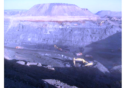
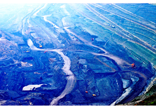
2. Resources
The amount of the resources in Huainan Coalfield is about 66 Gt, and the known coal deposits are 15 Gt.The average depths of the unknown seams are over 1000 meters. The old coalfield on the south of the Huai River produce 1/3 coking coals and a few gas coals; Panji Coalfield on the north of Huai River produce gas coals, most of which contain middle or more gas, low sulfur, and belong to better coals for coking. The refractory clay mines intergrow in the coal system. At present, it is known that there are 6Gt of coals in the area of Xiejiaji and Xinzhuang.The gas in the old coalfield of Huainan is high, so the prospect for utilizing is very good.
3. Geological condition for mining
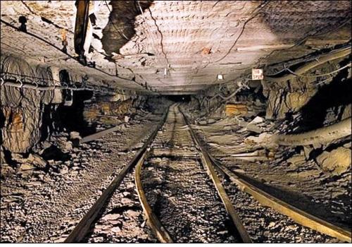
Huainan coalfield is mainly dipping coal seam of middle thickness, which is the middle level difficulty on construction and mining condition is ordinary. The loose seam of Quaternary System is 0 to 800 meters thick, which become thicker from east to west and from south to north. Because it contains grits and drifting sand seam, it needs special shaft sinking method to construct the shafts. The water supplies are mainly from rain and the permeating of the water among the sand seam of Quaternary System. The hydrology and geology condition are simple, but the karst water of the gray stone in Taiyuan Formation is complex, which is passed through by the reversed stratum and fault, influencing the mining of the coal seam in Permian Period.


 Busiunion
 Busiunion